Trustworthy GeoAI & Uncertainty Quantification
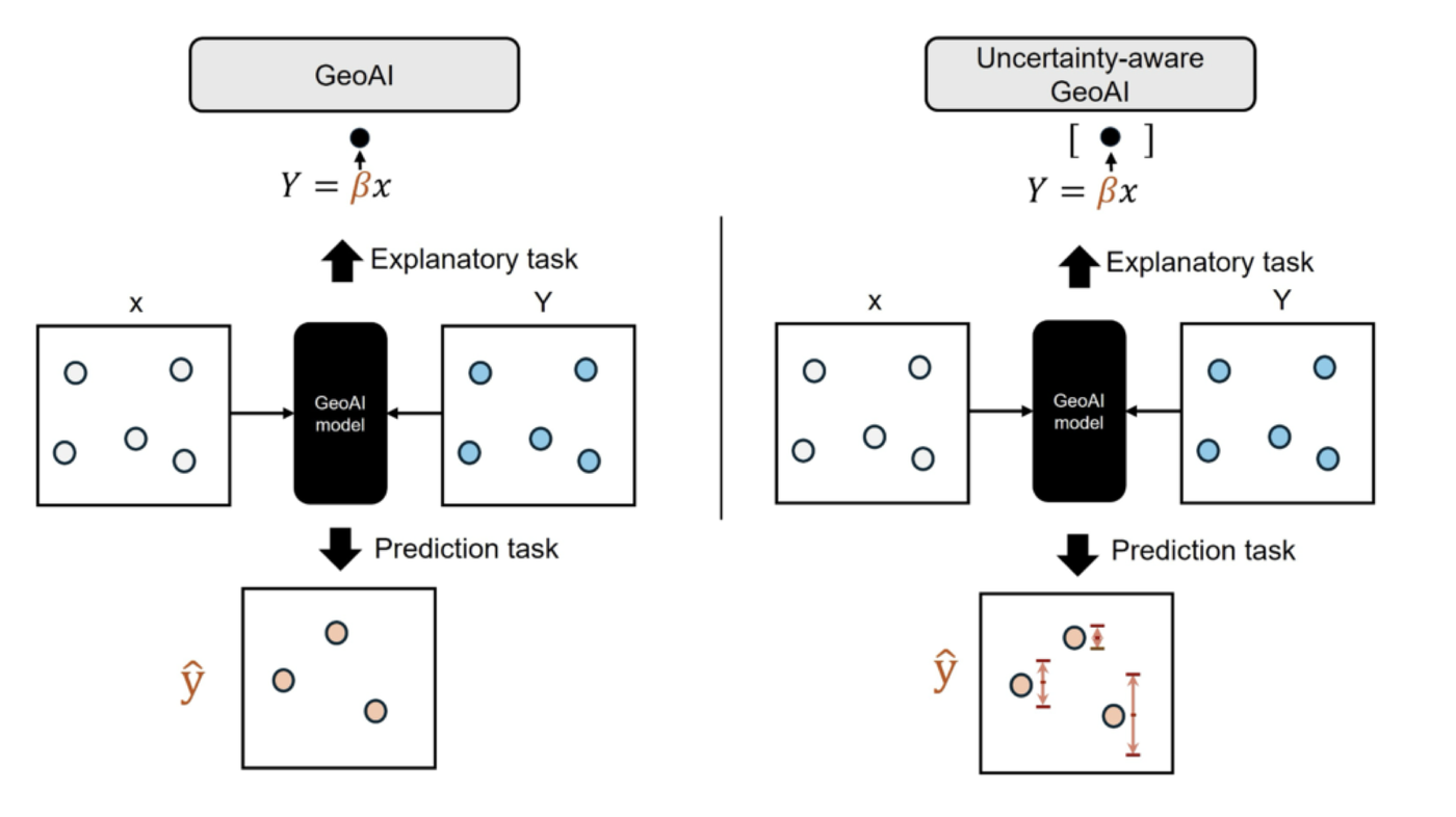
As GeoAI models grow in complexity, understanding when and why they fail becomes critical. This research line develops model-agnostic frameworks for quantifying uncertainty and ensuring interpretability in geospatial predictions.
GeoConformal prediction provides distribution-free, spatially calibrated prediction intervals for any spatial model. GeoXCP extends uncertainty quantification to the explanations produced by explainable AI methods. Complementary work uses visual analytics to help users understand predictability and uncertainty in population distributions and other spatial phenomena.
- GeoConformal prediction: model-agnostic spatial UQ framework (Annals of the AAG 2025)
- GeoXCP: uncertainty quantification for spatial explainable AI (IJGIS 2026)
- Visual analytics for understanding predictability and uncertainty in population distributions (IJGIS 2025, No.1 most read)
- Quantifying uncertainty in spatial prediction for nonstationary processes (Annals of the AAG 2026)
- Ethical spatial analysis: revealing endogenous bias through visual analytics
- Ontological and explainable framework for decoding AI risks from news data
- GeoCP — Python package (
geoconformal) for model-agnostic uncertainty quantification of any spatial prediction model - GeoXCP — Python package for uncertainty quantification of spatial explainable AI models
Interactive tools for exploring spatial uncertainty, model explanations, and prediction reliability.
Short animations that turn model explanations into a visual narrative.
Each dot is one 100 m grid cell in Munich. The dots start as a SHAP dependence plot—almost everywhere, night-time light adds little and the model leans on built form instead—then fly to their true locations, revealing that the strong negative contributions are not scattered at random but concentrate in specific parts of the city.